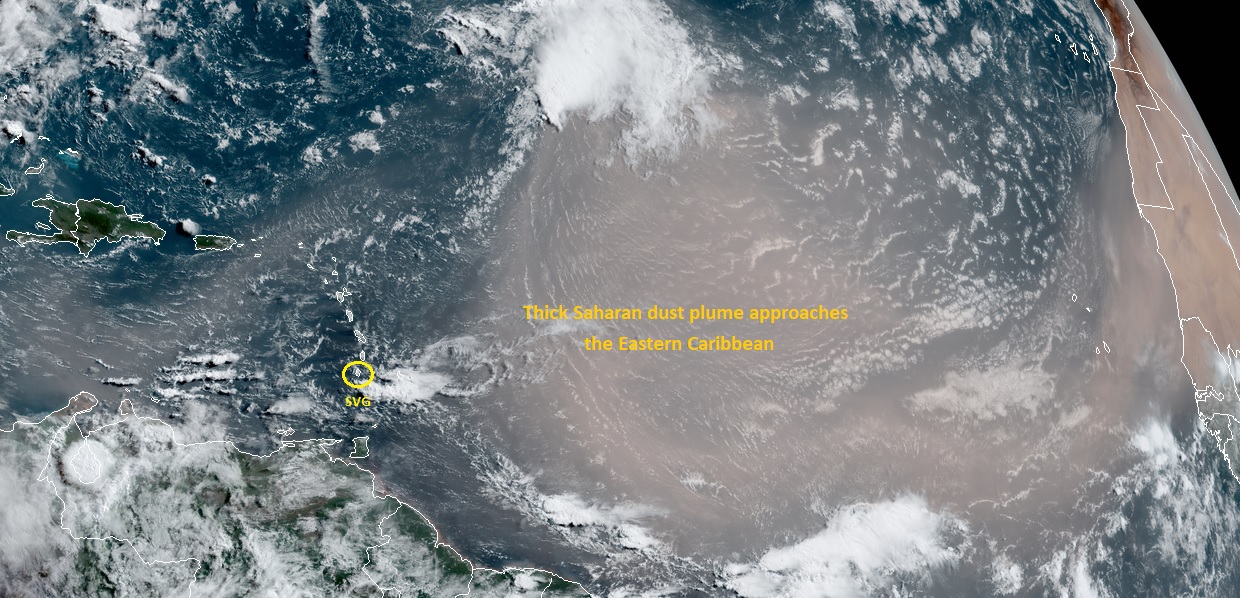
A dense plume of Saharan dust draws closer to the Eastern Caribbean limiting the chances of any deep shower activity for the first few days of next week. In addition, the haze would significantly lower the visibility across St. Vincent & the Grenadines tonight with an increase in concentrations by tomorrow(Sunday). Small-craft operators should therefore exercise caution for reduced visibility. A ridge pattern should gradually build by Sunday afternoon resulting in fair to partly cloudy and breezy conditions, with only a few brief isolated showers expected across the islands up to Tuesday.
Moderate and occasionally strong (20km/h – 40km/h) east south east to easterly(ESE-E) trades will move across the islands within the next 24 hours, becoming east north easterly(ENE) around Monday. A slight increase(near 45km/h) is anticipated from Sunday afternoon.
Slight to moderate sea conditions, with swells peaking to 1.2m on the western coasts and around 2.2m on the eastern coasts are forecast over the next 24 hours. Generally moderate(1.8m - 2.5m) conditions are anticipated from late Sunday. Small craft operators and sea-bathers should exercise caution for above normal sea swells.
NOAA GOES-16 Satellite Imagery at 740 am 20th June 2020 showing thick Saharan dust plume approaching the Eastern Caribbean