Instability associated with a tropical wave triggered some light to moderate scattered showers across the mainland shortly after noon. Some isolated thunderstorms were experienced in the process. Similar conditions are anticipated tonight as the wave progresses further west of the island chain. The chance of showers decreases tomorrow, however moisture trailing the wave should allow for occasional cloudy skies. In addition, Saharan dust concentrations are expected to increase tomorrow (Friday). Small craft operators and persons with respiratory concerns should continue to exercise caution for low visibility and poor air quality. Fair to partly cloudy conditions with isolated showers are forecast during the weekend.
Gusty winds should accompany showers over the passage of the night, while moderate to occasionally strong (25km/h - 45km/h)east north east to easterly (ENE-E) trades will move across the islands between Friday and Sunday.
Moderate sea conditions with swells peaking to 1.5m on the western coasts and 2.5m on the eastern coasts are forecast during the next 48 hours. Small craft operators and sea bathers should continue to exercise caution for above normal sea swells. A slight improvement(1.5m to 2.0m) is anticipated from late Saturday evening.
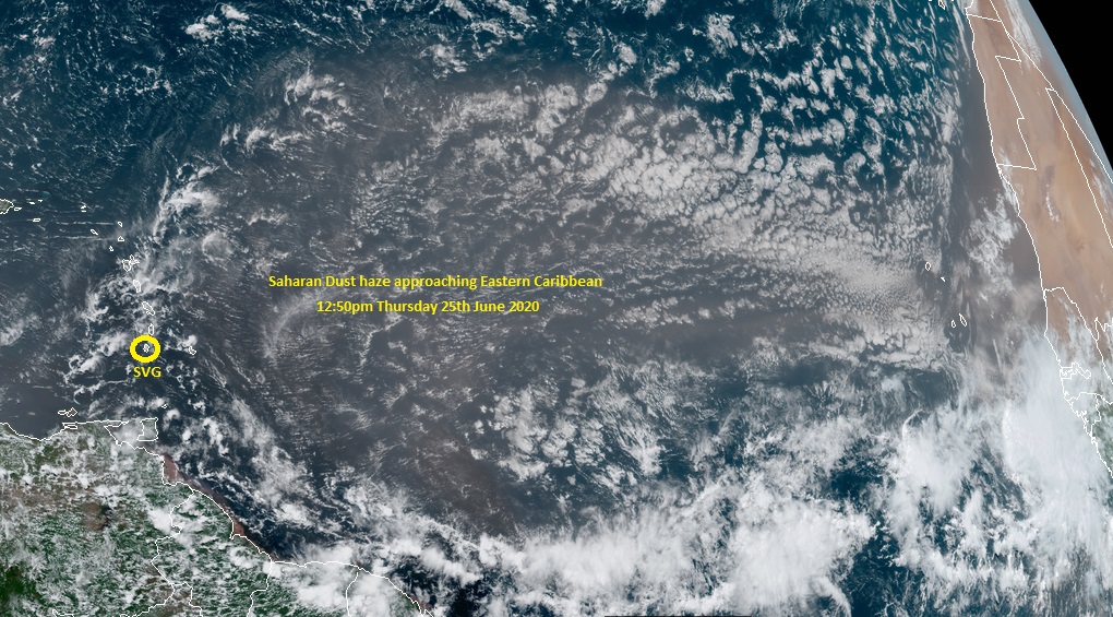
NOAA Goes-16 Imagery at 12:50pm 25th June 2020: Saharan Dust approaching the Eastern Caribbean