Breezy and hazy conditions should persist across St. Vincent & the Grenadines over the next few days. Shallow patches of moisture can instigate some passing showers over the afternoon to evening period today, meanwhile a tropical wave inches closer to the island chain. By late Saturday, SVG could be influenced by this wave and there is a medium chance of showers during nightfall. The potential for significant showers and thunderstorm activity increases early Sunday. Additional thunderstorm activity and showers are anticipated on occasions across Monday.
Moderate to strong (~25-40km/h) trades will move across the islands over the next 12 hours, before a slight decrease(~20-35km/h) on Saturday and Sunday. A further decrease(~10-20km/h) is likely on Monday. An east north easterly flow is anticipated over the next 2 days before becoming south easterly on Monday.
Sea conditions are are forecast to be moderate (1.5m-2.0m) in open water across the weekend. Small craft operators and sea-bathers should therefore exercise caution for above normal sea swells and gusty winds especially on eastern coasts. Sea conditions could improve(1.0m-1.5m) by late afternoon Monday.
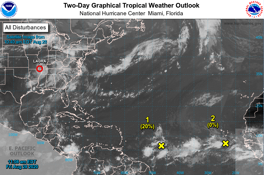
BELOW: NOAA Satellite Image showing disturbance(#2 on image at 10:40 am 28th August 2020)
At 8am: A tropical wave located about 900 miles east of the Windward Islands is producing an area of showers and thunderstorms. Some gradual development of this system is possible during the next several days while it moves westward at about 15 mph toward the eastern Caribbean islands.* Formation chance through 48 hours...low...20 percent.* Formation chance through 5 days...low...30 percent.