Breezy and slightly hazy conditions should persist across St. Vincent & the Grenadines over the next few days. Shallow patches of moisture can instigate some passing showers across Friday, meanwhile a tropical wave inches closer to the island chain. By late Saturday SVG could be influenced by this wave and there is a medium chance of showers during nightfall. The potential for significant showers and thunderstorm activity increases early Sunday.
Moderate to strong (~25-40km/h) trades will move across the islands over the next 24 hours, before decreasing(~20-35km/h) on Saturday. A further decrease(~15-30) is likely on Sunday. A predominantly east north easterly flow is anticipated over the next 3 days.
Sea conditions are currently slight to moderate (1.2m-2.0m) but a further deterioration to generally moderate (1.5m-2.0m) is likely across Friday. Small craft operators and sea-bathers should therefore exercise caution for above normal sea swells and gusty winds especially on eastern coasts. Sea conditions could improve(1.0m-1.5m) by late afternoon Sunday.
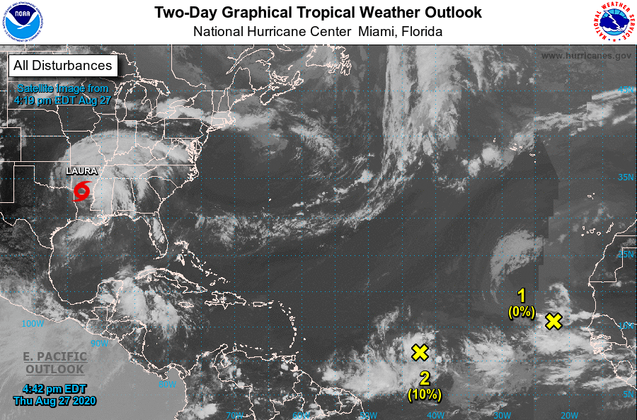
BELOW: NOAA Satellite Image showing disturbance(#2 on image at 4:19 pm 27th August 2020)
At 2pm: Shower and thunderstorm activity has increased today in association with a tropical wave over the central tropical Atlantic. Gradual development of this system
is possible over the next several days as it moves westward at 15 to 20 mph. * Formation chance through 48 hours...low...10 percent. * Formation chance through 5 days...low...30 percent.