Weather Outlook- 26th July 2020 (12 noon)
A tropical wave would begin to affect the islands tonight into Monday, triggering some scattered moderate showers and possible thunderstorms. The chances of showers decreases on Monday afternoon due to dry air interaction. Early Tuesday however, instability trailing the wave would allow for some scattered showers. The Grenadines could experience these conditions during nightfall as a shearline affects the islands. Instability associated with a disturbance could trigger a few showers across the mainland late Wednesday afternoon.
Moderate to fresh(~20-30km/h) trades are anticipated up to Monday. An east to east north easterly(E-ENE) flow would shift to east south easterly(ESE) on Monday afternoon. Occasionally strong(~40km/h) ENE trades will cross the islands on Tuesday.
Slight to moderate sea conditions with swells peaking near 1.0m on the western coasts and 2.0m on the eastern coasts are expected across the islands. A slight deterioration(1.5m-2.2m) is likely on Tuesday.
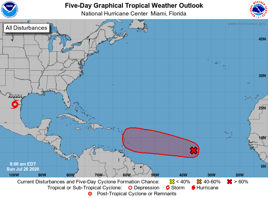
The St. Vincent & the Grenadines Meteorological Services is closely monitoring an area of disturbed weather in the east Atlantic. Currently there is fairly good consensus in the model guidance that the system will track westward and then west north-westward over the next few days. With that said, such a track would take the centre and associated cyclone winds closer to the Leeward Islands (well away from SVG) by Thursday 30th July 2020.


